
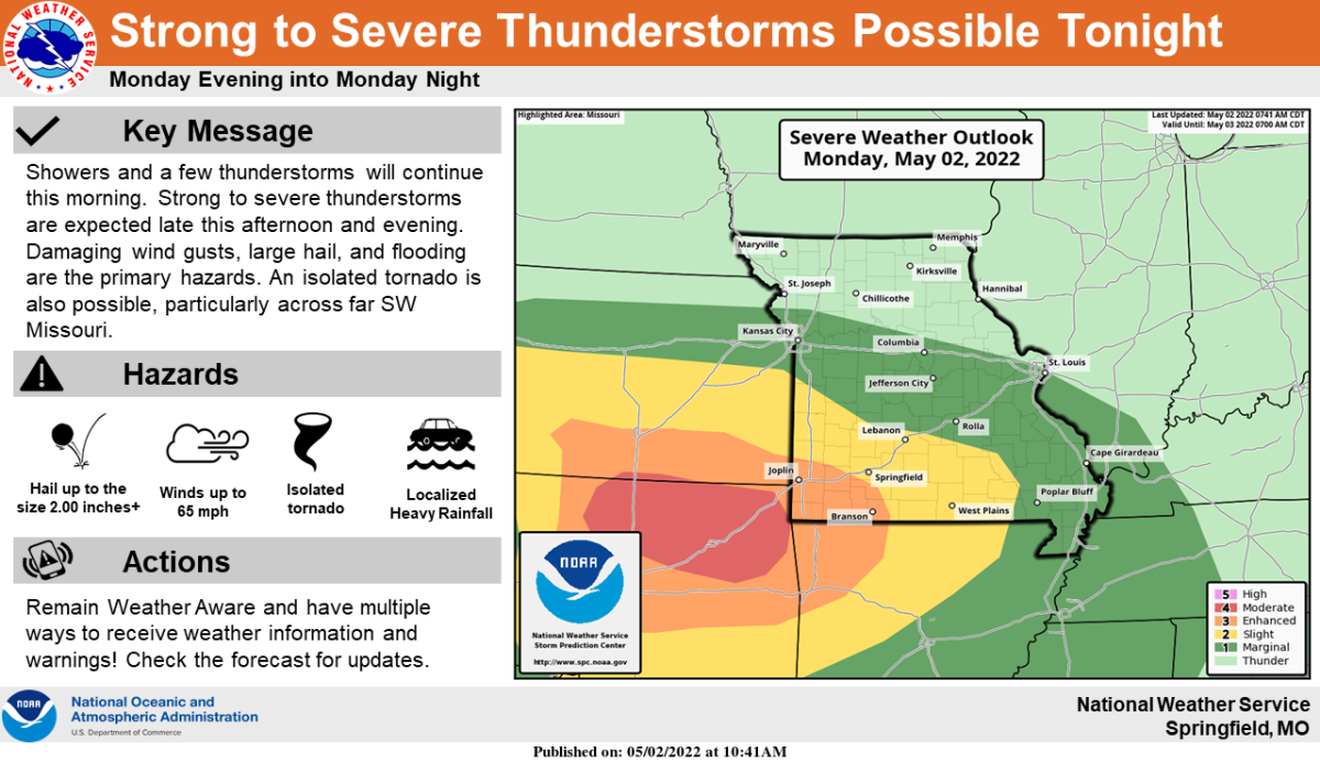
While showers and storms are expected off and on throughout the day Monday, severe thunderstorms are more likely Monday evening into the overnight hours.
The National Weather Service says hail up to two inches in diameter (just over golf ball size) and damaging winds will be the primary hazards, with a few tornadoes possible west of Springfield.
A Flood Watch is in effect through Tuesday morning for most of the Ozarks, with a widespread one to two inches of rain possible in southwest Missouri.
We’ll keep you up to date with the latest watches and warnings on 93-3 A-M 560 KWTO.