
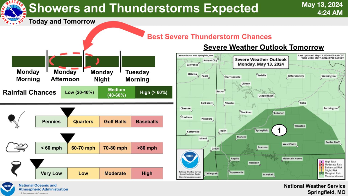
Showers and thunderstorms will move back into the Ozarks Monday and last into Tuesday. The National Weather Service says widespread rainfall totals of 1 to 1.5 inches are expected, with localized amounts up to 2-3 inches.
Forecasters say this is not expected to cause widespread flooding, but the ground is still saturated from recent rains, so localized ponding and elevated water levels are possible.
The weather service says there’s also a marginal (1 in 5 risk) for a few strong storms south of I-44 Monday afternoon and evening.
Most showers and storms, though, will not be severe, but there may be widespread lightning.
We’ll have any watches or warnings issued by the National Weather Service on 93-3 and A-M 560 KWTO.