
More showers and thunderstorms are possible as we head into the Memorial Day weekend, but there will be several dry periods, too.
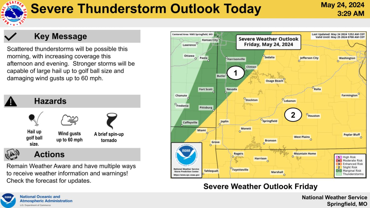
The National Weather Service says scattered thunderstorms will be possible Friday morning, with marginally strong to severe storms.
More widespread storms and an increased severe weather risk Friday afternoon, with large hail to the size of golf balls and 60 mile per hour winds being the main hazards.
A strong upper-level disturbance will move across the central U.S. on Saturday, bringing the potential for organized severe weather.
The highest chance for severe storms in our area is late Saturday night into Sunday, with a Level 3 “enhanced risk” for severe weather north and west of Springfield.
We’ll have updates to the weather forecast, along with watches and warnings and any damage reports from across the Ozarks on 93-3 and A-M 560 KWTO.