
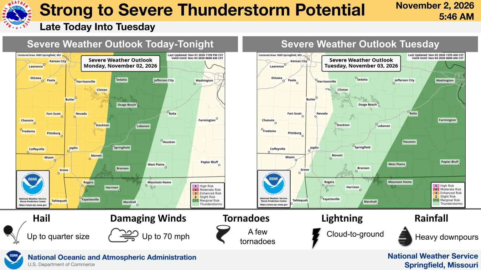
Be weather aware for severe weather to impact parts of the Ozarks from late Monday night into Tuesday morning.
What We Know: There is a marginal (Level 1) to slight (Level 2) risk for severe weather covering much of the Ozarks Monday night into Tuesday. The National Weather Service says severe winds will be the primary threat, but there’s also a low tornado risk west of Highway 65. Forecasters say if tornadoes occur, they could be as strong as an EF2.
What We Don’t Know: Forecasters say atmospheric instability looks to be weak with this system, with strong wind shear and upper-level winds being the driving force for severe weather potential. Because of the limited instability, one possible scenario is “underperformance.” If wind shear and divergence aloft are not sufficient to make up for the lack of instability, storms may not be as strong as expected.
Why It Matters: It’s been awhile since we’ve had severe weather in southwest Missouri, and these storms are expected to move through at night, with a strong tornado not out of the question. Get your severe weather updates from the team at 93-3 and A-M 560 KWTO.
What’s Next?: There is a marginal risk for severe storms in the eastern Ozarks again Tuesday afternoon and evening. The National Weather Service says strong wind gusts will be possible with scattered thunderstorm redevelopment. An isolated tornado may occur.
(Graphic courtesy of National Weather Service Springfield, MO)