
A storm system approaches the Ozarks Wednesday, bringing the threat of heavy rain, flash flooding, and strong to severe thunderstorms.
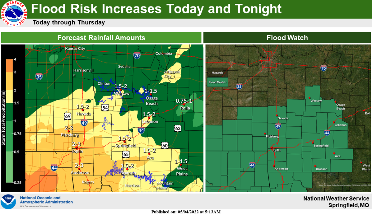
The National Weather Service says a Flood Watch is in effect through Thursday afternoon for most of southwest Missouri.
Widespread rain amounts of one to three inches are expected in the Ozarks, with local pockets of four inches possible.
Forecasters say significant flash flooding is possible in areas that experience training, or repeated thunderstorms.
Numerous state highways and county routes are likely to become flooded and impassable, with river flooding also likely.
There will also be the potential for severe weather over the next two days, with a couple of marginally severe thunderstorms possible Wednesday and Wednesday night.
The severe weather potential is even greater Thursday, with large hail, damaging winds and tornadoes possible, especially along and south of I-44.
We’ll have the latest watches and warnings on 93-3, A-M 560 KWTO.