Very little change from weather patterns for the last week is expected for Thursday into the weekend.
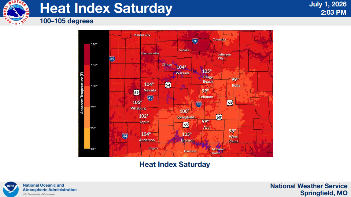
What We Know: More hot days are ahead for the Ozarks as temperatures are staying in the low 90s with heat indices around 100 from Thursday through Saturday.
The National Weather Service of Springfield says a few isolated thunderstorms will be possible later Thursday morning into early evening. Most locations should remain dry.
Partly cloudy skies and slightly more moisture in the air may led to a couple of pop-up showers in the afternoons.
What It Means: The fourth should stay relatively dry and the evening will cool to the low 80s, so celebrations should not be interrupted.
A small cold front is expected Sunday, but will not bring much relief from the heat as temperatures are only expected to drop to the upper 80s.
(Graphic courtesy of the National Weather Service Springfield, MO)