
Hail up to the size of golf balls and damaging winds up to 70 miles per hour are possible with storms in the Ozarks Tuesday evening and overnight Wednesday morning.
The National Weather Service says thunderstorm chances will increase through the late afternoon and evening hours.
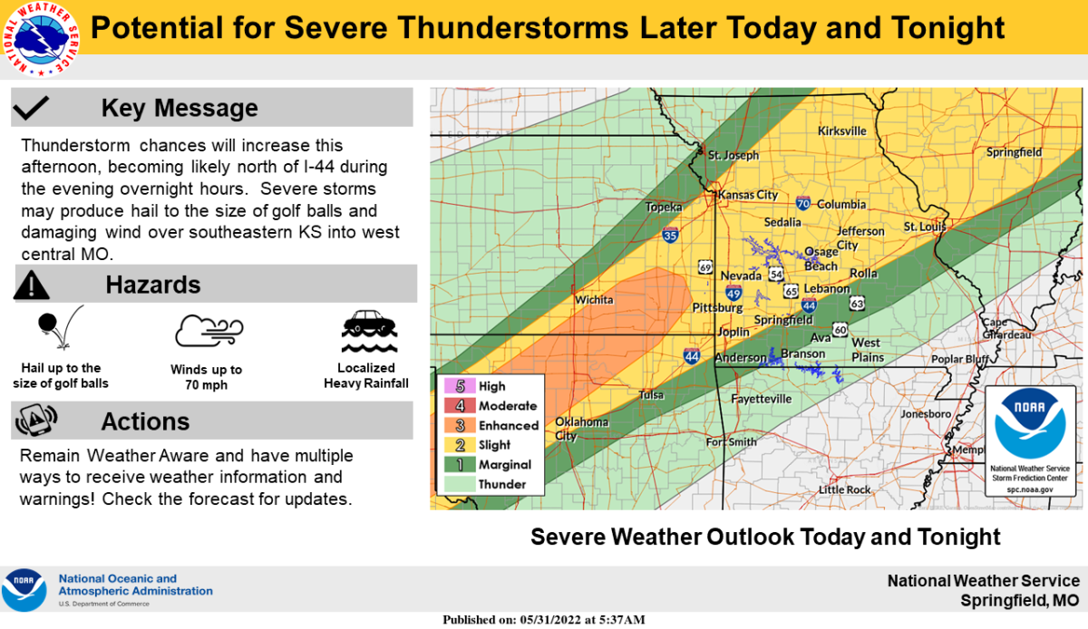
The better chance for severe weather will be northwest of the I-44 corridor, where a
“slight,” or Level 2 threat level exists.
Thunderstorms will occur again Wednesday into Wednesday night.
Forecasters say dime to quarter size hail may be possible in a few of the strongest storms Wednesday afternoon into the overnight hours, along with winds up to 50 to 60 miles per hour, and localized heavy rainfalls
Most of southwest Missouri is under a “marginal,” or Level 1 risk for Wednesday.
In addition, a Flood Watch is in effect for Barton, Cedar, Hickory, St. Clair and Vernon Counties from Tuesday evening through Wednesday morning.
Conditions will be favorable for flash flooding to develop, with rainfall amounts of two to three inches, and locally higher amounts possible.