
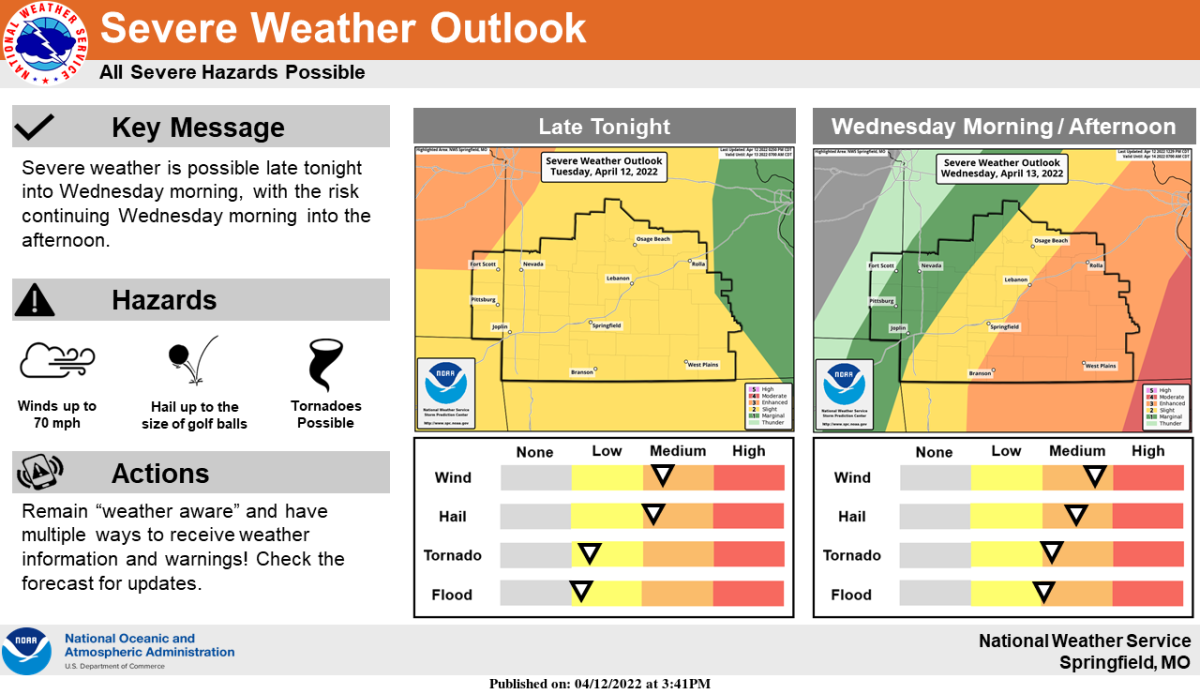
Another round of severe thunderstorms will be possible in southwest Missouri as early as late Tuesday night, but become more likely Wednesday morning into the afternoon.
The National Weather Service says any storm potential Tuesday evening will depend on the strength of a cap that’s in place, limiting storm development.
The overall highest risk for impactful weather looks to be Wednesday, when all modes of severe weather are possible, including large hail, damaging winds and tornadoes.
An “enhanced,” or Level 3 risk for severe storms covers areas south of I-44 and east of Highway 65 on Wednesday.
The Springfield metro area is in a Level 2, or “slight” risk for severe storms on Wednesday, while areas in the western Ozarks along the I-49 corridor are in a Level 1, or “marginal” risk zone.
Forecasters say winds outside of any storms could gust at 35 to 45 miles per hour.
KWTO News will keep you up to date on the latest severe weather information, including watches, warnings, and damage reports on 93-3 AM 560 KWTO.