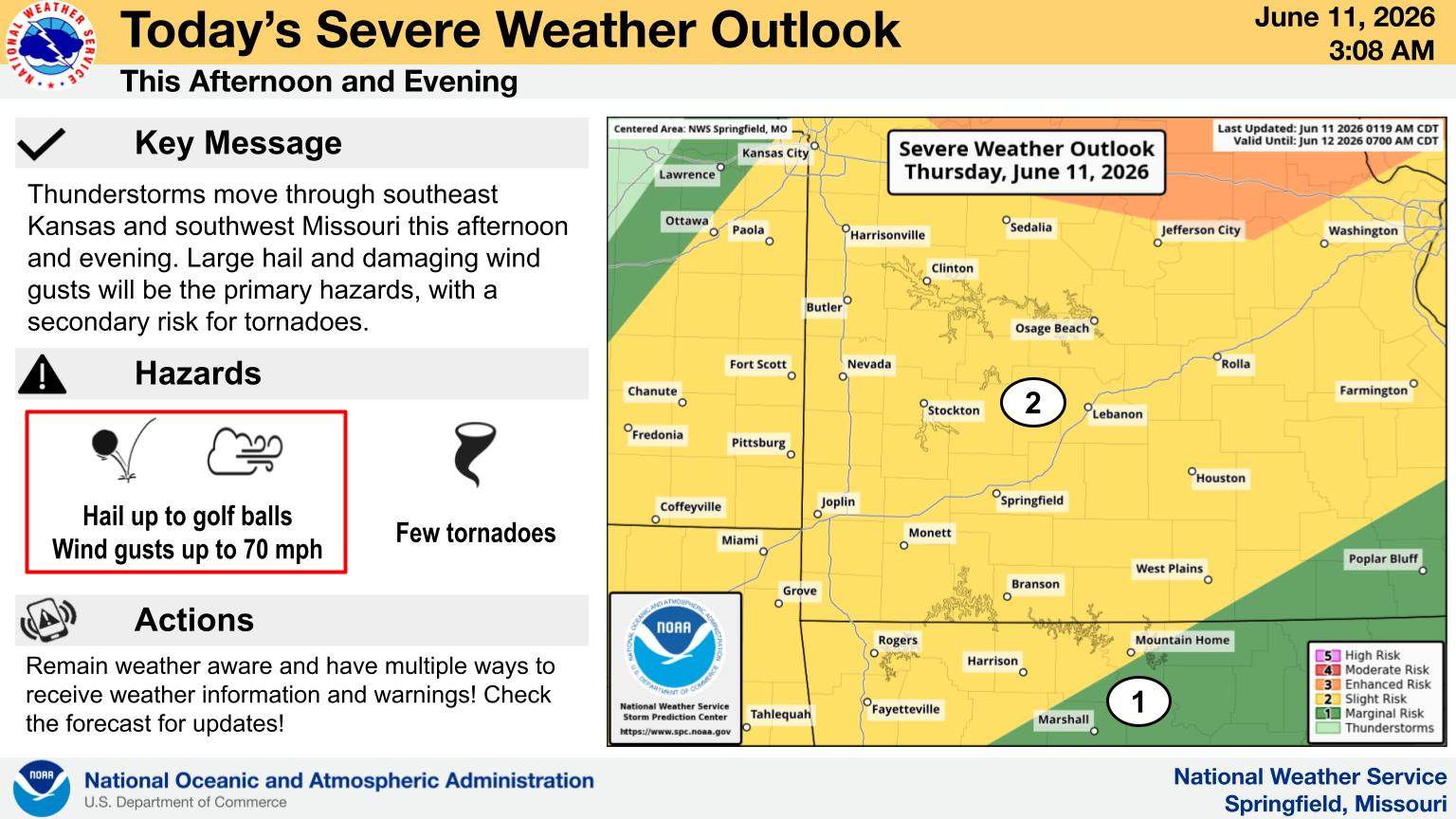
Thunderstorms will move through southwest Missouri Thursday afternoon and evening.
What We Know: Large hail and damaging wind gusts will be the primary hazards, with a secondary risk for tornadoes.
What We Don’t Know: How far severe storms will track south before losing intensity. The greateast threat is along and north of I-44.
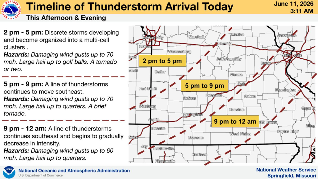
Where to Find The Latest: We’ll have the latest forecast changes, plus coverage of any watches and warnings on 93-3 and AM 560 KWTO. Also, see the graphic below for a timeline of thunderstorm arrival in different areas of the Ozarks.
Graphics courtesy of National Weather Service Springfield, Mo