
Showers and thunderstorms moved into southwest Missouri Monday morning, and we’ll have several chances for severe storms through mid-week.
There is a marginal risk for an isolated strong to severe storm Monday afternoon and early evening between 3 and 7 pm.
The National Weather Service says the primary risks are hail up to the size of quarters and damaging wind gusts up to 60 miles per hour.
Many areas may remain completely dry through Monday evening.
There are better chances for severe weather on Tuesday.
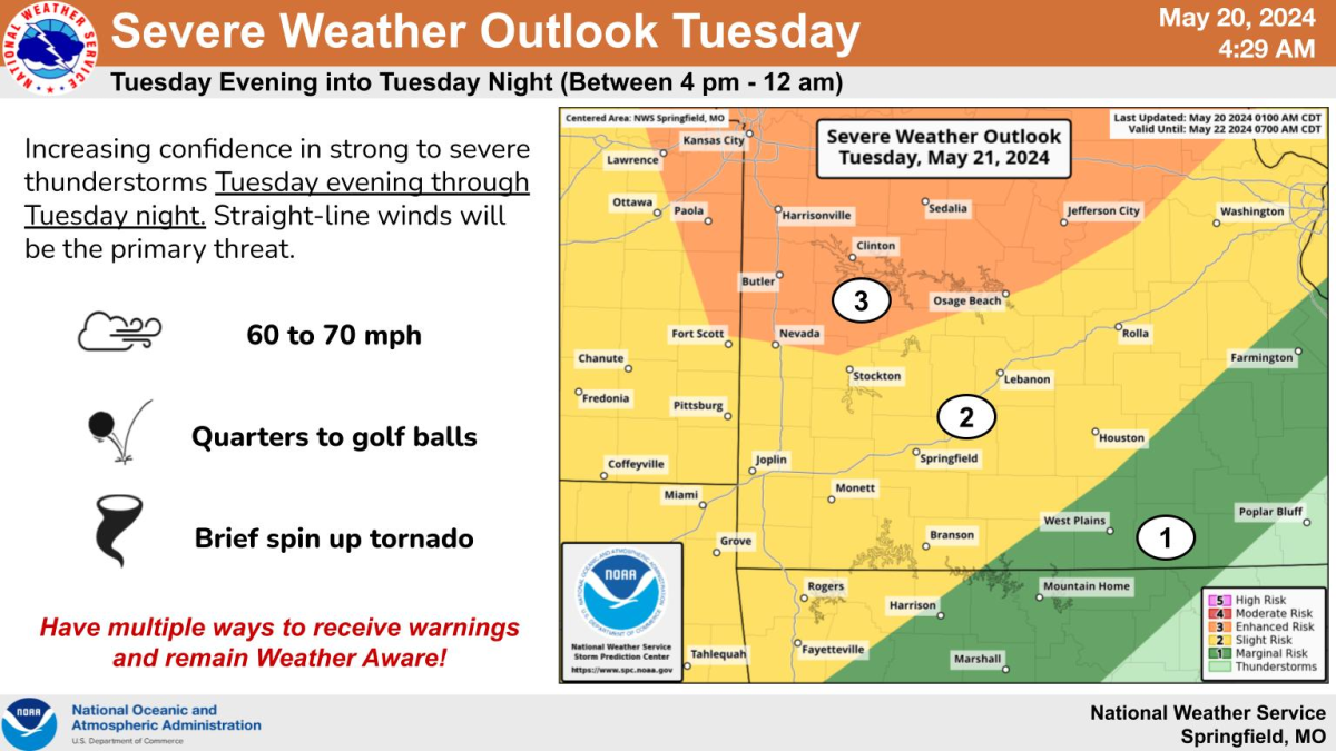
Forecasters say a line of strong to severe storms will move through the area Tuesday evening into Tuesday night between 4pm and 12am.
The highest chances for severe weather on Tuesday will be along and north of a line from Nevada to Osage Beach, where there’s a level 3 “enhanced risk.”
Primary hazards from Tuesday’s storms will be damaging wind gusts, with severe hail, a brief spin-up tornado and localized flash flooding.
There’s also the potential for strong to severe thunderstorms on Wednesday, with hail and winds being the biggest threats. Chances of bad weather are greatest along and south of I-44.
We’ll keep you up to date with the changing forecast, as well as any watches and warnings, on 93-3 and A-M 560 KWTO.