
UPDATE 10:05 p.m. Sunday: The National Weather Service has issued a Severe Thunderstorm Watch for all but the far eastern Ozarks through 4:00 a.m. Monday. Hail the size of golf balls and damaging wind gusts are the biggest threats. The tornado threat is low.
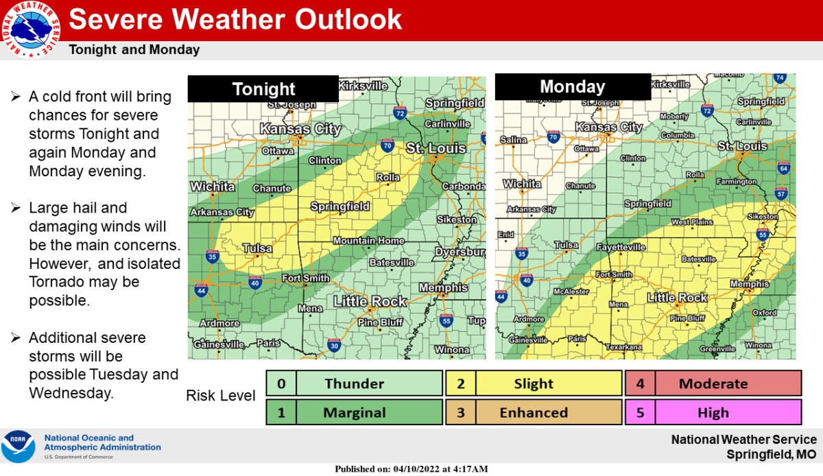
A cold front will bring chances for severe thunderstorms Sunday night into Monday morning, with another round to affect areas south of I-44 Monday evening.
More severe weather is expected Tuesday afternoon and night, with the most widespread severe storms Wednesday into Wednesday night, including large hail, damaging winds, and tornadoes.
Ahead of the storms, gusty south winds of 30 to 40 miles per hour will be possible.
The highest winds will be over far southwest Missouri.
Use caution while driving, and tie down or move in loose objects.
Large hail up to the size of ping pong balls and damaging downburst winds will be the biggest threats from Sunday night’s storms, but a tornado may be possible along the frontal boundary.
Showers and thunderstorms will continue on Monday as the front slows or stalls across the area, with afternoon heating leading to more storm development, mainly along and east of the front in the southeastern Ozarks.
On Tuesday, a strong cap should suppress any storm development through the afternoon hours, but storms are expected to fire up in eastern Kansas and move east into our area throughout the night.
Instability and shear will diminish with these storms as they push east, limiting their severe potential, so the best potential for severe weather Tuesday night will be in our far western counties along the I-49 corridor.
There is still some disagreement in models on where the surface low will track on Wednesday, but there remains the potential for all modes of severe weather, including tornadoes, with the current forecast.
93-3 and AM 560 KWTO will keep you up to date with the latest watches and warnings, along with spotter reports of storm damage.