
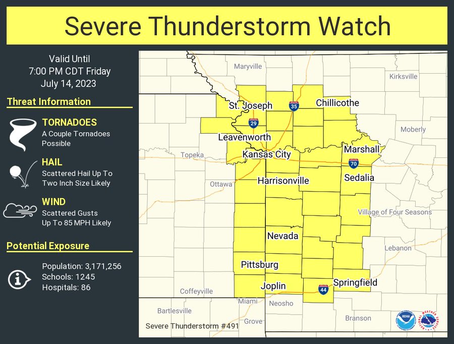
UPDATE: The National Weather Service has issued a Severe Thunderstorm Watch until 7:00 p.m. Friday for areas along and north of I-44 and along and west of Highway 65, including the city of Springfield.
A strong storm complex will move into the Ozarks by early Friday evening, and it will be capable of producing damaging winds, large hail and localized flash flooding.
The National Weather Service says wind gusts up to 80 miles per hour will be possible, as well as quarter size hail.
Areas west of Springfield from I-49 to Monett and Stockton are under a level three “enhanced risk” for severe weather, while the rest of the Ozarks is under a level two “slight risk.”
Forecasters say the tornado threat is very low, with damaging winds being the biggest threat.
Widespread rainfall totals of 0.5 to 1.5 inches are possible through Friday night, with localized amounts of two to four inches possible under heavier storms.
Areas that have received recent significant rainfall may be more vulnerable to flash flooding.
We’ll have live updates of any watches and warnings issued by the National Weather Service, as well as damage reports, on 93-3 and A-M 560 KWTO.