
With a number of outdoor gatherings planned across the Ozarks Sunday afternoon and evening, be weather aware for more severe weather.
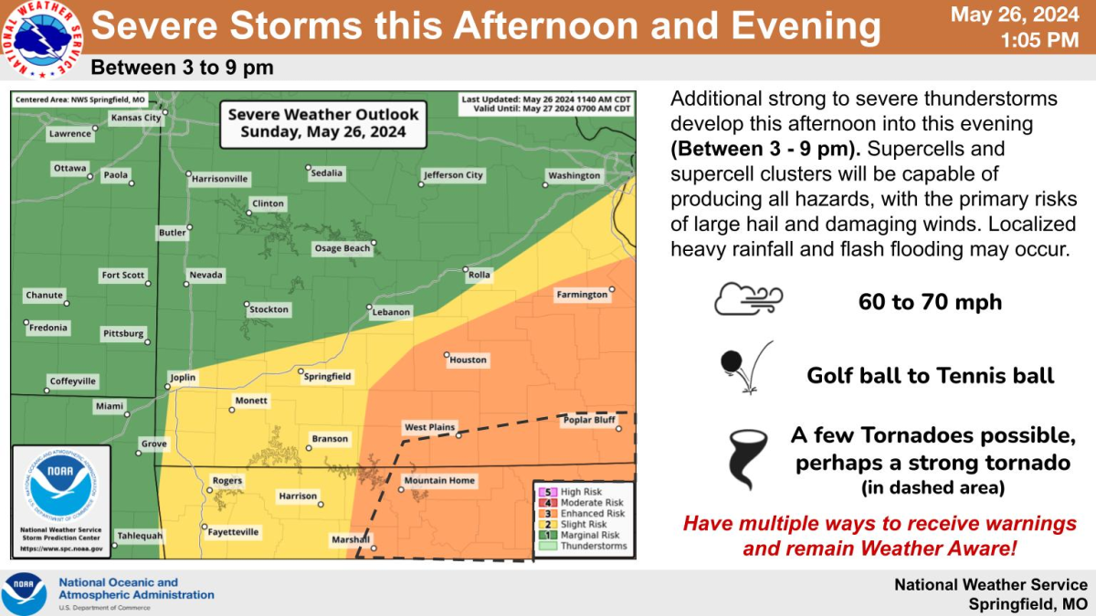
The National Weather Service says additional strong to severe thunderstorms will develop starting Sunday afternoon, with the severe weather risk between 3 and 9 p.m.
Supercells and supercell clusters will be capable of producing all hazards, with the primary risks being large hail and damaging winds. Localized heavy rainfall and flash flooding may occur.
The greatest severe weather risk will be south of I-44 and east of Highway 65 in the eastern Ozarks, with a Level 3 “enhanced risk” for severe weather.
Areas from Springfield and Branson and points west are under a Level 2 “slight risk” for severe storms.
We’ll have the latest forecast updates, along with any watches and warnings issued by the National Weather Service on 93-3 and A-M 560 KWTO.

(Graphic courtesy of National Weather Service Springfield, MO)