Be weather aware as you’re shooting off fireworks in the Ozarks Saturday night.
We had one round of severe thunderstorms move through central Missouri and the northern Ozarks on the afternoon of the 4th, leaving more than 80,000 electric customers without power.
The hardest hit area was Camden County, with more than half the county without electricity as of late Saturday afternoon.
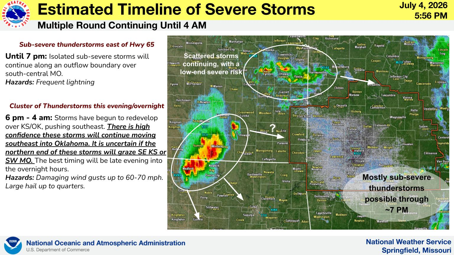
The National Weather Service says additional storms have developed over Kansas and Oklahoma late in the afternoon, and there is high confidence these storms will continue moving southeast into Oklahoma, but it’s uncertain if the northern end of those storms will graze southwest Missouri.
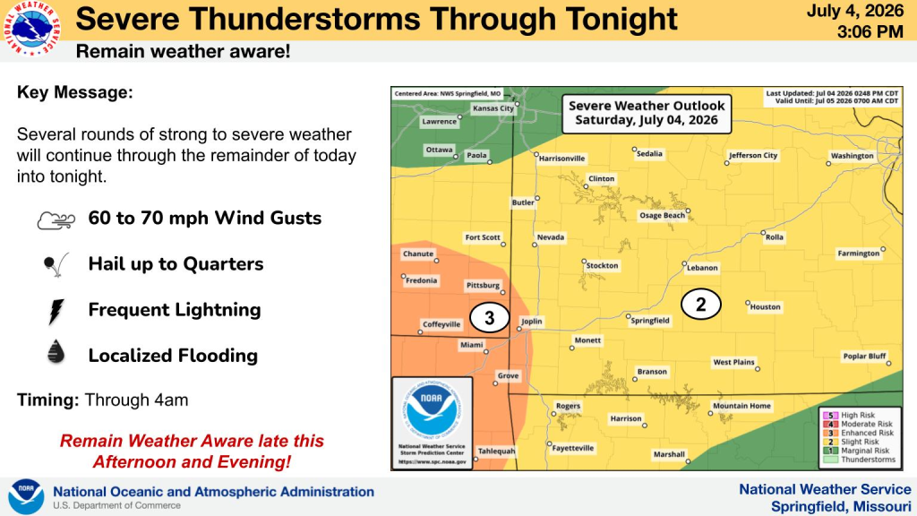
Any storms that do make it into the area will be capable of producing 60 to 70 mile per hour wind gusts, hail the size of quarters, frequent lightning and localized flooding.
Listen to 93-3 and AM 560 KWTO for updates on any warnings issued by the National Weather Service.
(Graphic courtesy of National Weather Service–Springfield, MO)