
9:05 a.m. UPDATE: The National Weather Service has issued a Severe Thunderstorm Warning for central Laclede County until 9:45 a.m. Parts of Pulaski, Camden, Maries and Miller Counties are also included in the warning. The storms are located along a line from near Osage Beach to west of Crocker to nine miles west of Fort Leonard Wood, moving northeast at 50 miles per hour. 60 mile per hour winds and quarter size hail are possible in the Waynesville and St. Robert areas, Richland, Dixon, Camdenton, Osage Beach and along Lake of the Ozarks. In addition, a Severe Thunderstorm Warning is in effect for eastern Wright County and northwestern Texas County until 9:30 a.m. with quarter size hail and 60 mile per hour winds the biggest threats.
8:30 a.m. UPDATE: The Severe Thunderstorm Warning for southwestern Webster, northwestern Douglas, and eastern Christian Counties is being allowed to expire at 8:30. The National Weather Service says the storm that prompted the warning has weakened below severe limits, and has moved out of the warned area. Small hail is still possible with this thunderstorm.
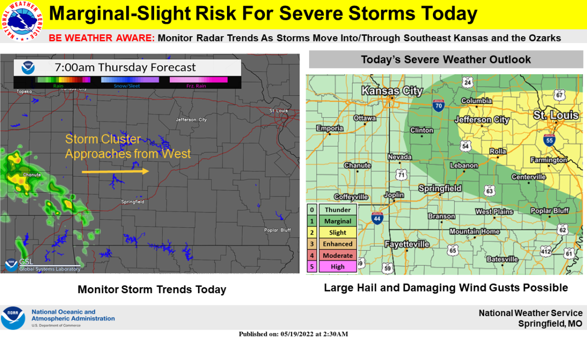
7:55 a.m. UPDATE: Here’s the latest from the National Weather Service:
STRONG TO SEVERE STORMS ACROSS SOUTHWEST MISSOURI EARLY THIS
MORNING WILL MOVE NORTHEASTWARD INTO CENTRAL MISSOURI THROUGH
THIS MORNING AND AFTERNOON. STORM INTENSITIES ARE EXPECTED TO
INCREASE THROUGH THE MORNING AND AFTERNOON AS THE STORMS MOVE
INTO AN AREA OF GREATER INSTABILITY. THE STRONGEST STORMS MAY BE
CAPABLE OF PRODUCING UP TO GOLF BALL SIZED HAIL, WIND GUSTS OVER
70 MPH AND POTENTIALLY A TORNADO OR TWO. THE GREATEST RISK WILL BE
EAST OF A LINE FROM WARSAW TO BOLIVAR TO ROGERSVILLE.
7:43 a.m. UPDATE: The National Weather Service has issued a Severe Thunderstorm Warning for southwestern Webster, northwestern Douglas, Christian, and northeastern Stone County until 8:30 a.m. A severe thunderstorm located near Highlandville is moving northeast at 45 miles per hour and may produce 60 mile per hour wind gusts and quarter size hail as it moves through Ozark, Sparta, Fordland, Chadwick, Rogersville, Highlandville, Spokane, Bruner, and Keltner.
Original Story: Thunderstorms that tracked across northeast Oklahoma and eastern Kansas have moved across parts of the Ozarks Thursday morning.
The National Weather Service says while nickel size hail is possible in several of these storms, quarter size hail and 60 mile per hour winds are possible in parts of northwestern Christian, northwestern Stone, Barry and Lawrence County, where a Severe Thunderstorm Warning has been issued until 8:00 a.m. Thursday.
We’ll keep you up to date with the latest warnings on 93-3 and A-M 560 KWTO.