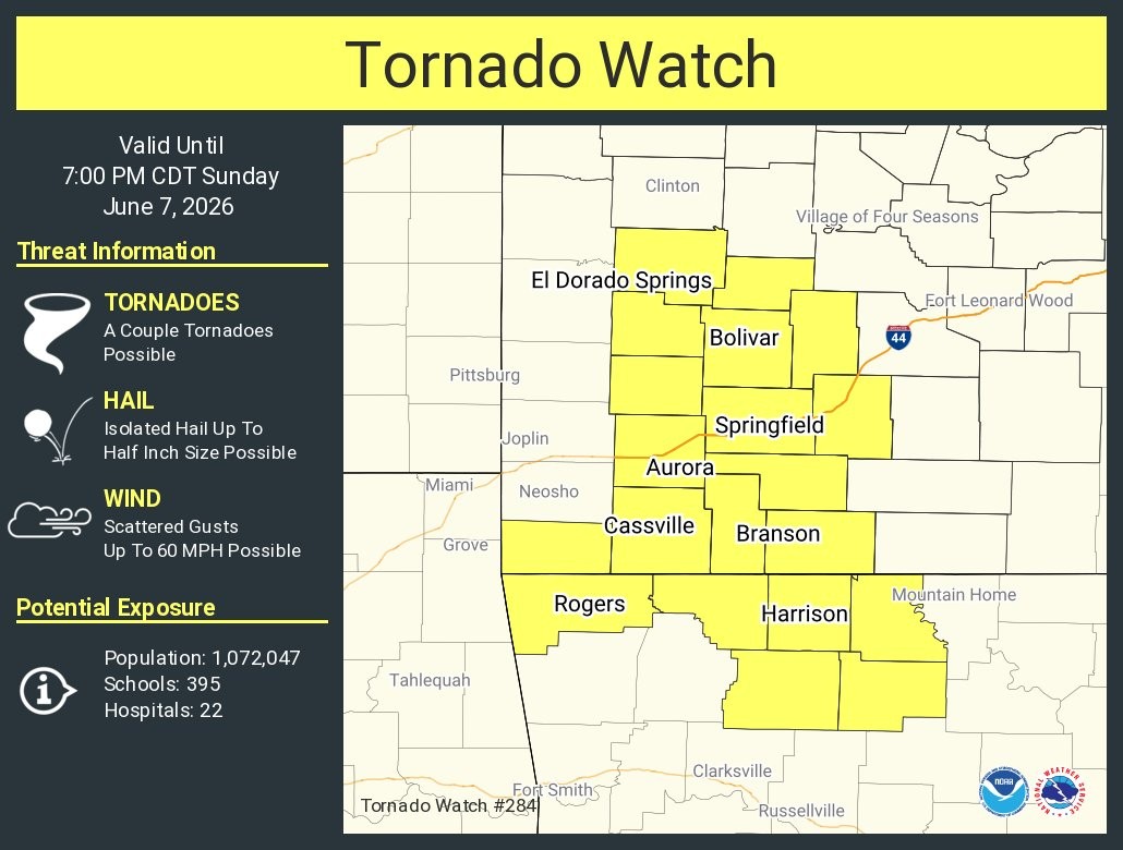
The National Weather Service has issued a Tornado Watch until 7:00pm Sunday for more than a dozen counties in southwest Missouri.
What We Know: The watch included the Springfield metro area of Greene, Christian, and Webster Counties, plus Barry, Cedar, Dade, Dallas, Hickory, Lawrence, McDonald, Polk, St. Clair, Stone and Taney Counties.
What We Don’t Know: How widespread the actual tornado threat will be.
What the experts are saying: There is a slight (level 2 out of 5 risk) for severe storms, with mostly a tornado/wind risk. This is why a short-fused Tornado Watch has been issued until 7pm Sunday for counties along Highway 65 where the environment for tornadoes is maximized. This set up is messy, and these spin-ups will be very quick and brief.
What other impacts are we facing? A Flood Watch is in effect for the Ozarks through Monday afternoon. Showers and thunderstorms with rainfall rates of 2 to 3
inches per hour are expected Sunday through Monday which may
lead to flash flooding in urban and low-lying areas. Rainfall
amounts of 1 to 3 inches expected with locally higher amounts
up to 5 to 7 inches possible.
(Graphic courtesy of National Weather Service Springfield, MO)