
A winter storm appears to be headed for the Ozarks on Thursday, with accumulating snowfall becoming increasingly likely, along with bitterly cold temps and dangerous wind chills.
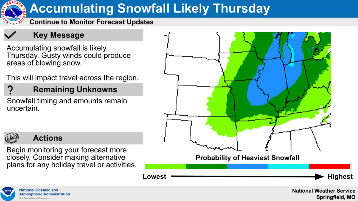
The National Weather Service says from a probabilistic standpoint, the trend continues upward in accumulating snowfall potential for Thursday.
There’s a 60-80% probability of greater than two inches, a 40-60% probability of greater than four inches, and a 20-40% probability of greater than six inches of snow.
Despite the increasing probabilities, there remains uncertainties that will impact the details of this system, including the exact track of the low and minor timing differences.
The details of the system will be assessed over the coming days, including potential snowfall amounts, blowing snow potential, snow ratios and travel impacts.
Forecasters say given the high confidence in a cold airmass settling into the region, snow that does fall will likely accumulate.
Confidence in at least minor travel impacts is high, with lower confidence in moderate impacts.
More snow is expected north and east of I-44 toward central Missouri and the St. Louis region.
One thing that is even more certain is dangerously cold air will filter into our area Thursday.
Expect the high temperature on Thursday to occur near midnight as temps plummet the remainder of the day.
The weather service says while there remains some minor timing differences on frontal passage, the general consensus is for temperatures in the single digits to teens by Thursday afternoon.
Meanwhile, wind gusts approaching 30 to 45 miles per hour will result in wind chills ranging from -15 to -30 areawide.
Lows Thursday night will fall below zero, with many locations at or below -5.
Wind chills of 25 to 30 below appear likely heading into Friday morning.
Frostbite can occur in 15 minutes or less in these conditions, which will pose a high threat to vulnerable populations, such as those without sufficient shelter or warming.
The weather service says the bitter cold continues into Friday, with highs only hitting the single digits, with dangerous wind chills.
Another cold night of lows below zero is expected Friday night.
The bitter cold weather is expected to continue through the Christmas weekend with highs on Saturday in the teens and Christmas Day highs in the 20’s.
A return to near normal temps is expected heading into next week.