
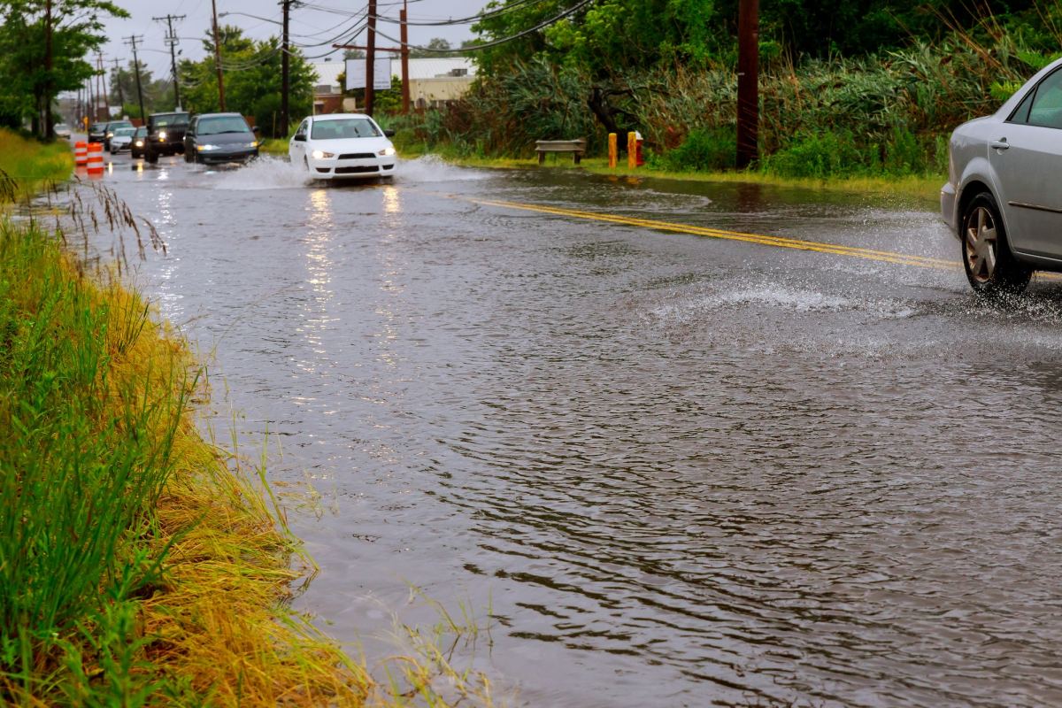
Between one and three inches of rain per hour has fallen in the Springfield area Monday afternoon, leading to dangerous flash flooding, stranded vehicles and road closures.
Check road closures as they are reported to MoDOT here with the MoDOT Traveler Information Map.
We’ve had reports of three to more than four inches of rain in parts of Springfield.
At 3:24 p.m., the National Weather Service upgraded its Flash Flood Warning for the Springfield area to considerable and life-threatening.
The Weather Service issued this statement at 3:46 p.m.:
AT 346 PM CDT, EMERGENCY MANAGEMENT REPORTED NUMEROUS WATER
RESCUES ONGOING IN THE CITY OF SPRINGFIELD. BETWEEN 2 AND 4 INCHES OF
RAIN HAVE FALLEN IN THE LAST 1 TO 2 HOURS. THE EXPECTED RAINFALL RATE
IS 1 TO 3 INCHES IN 1 HOUR. ADDITIONAL RAINFALL AMOUNTS OF 1 TO 2
INCHES ARE POSSIBLE IN THE WARNED AREA. FLASH FLOODING IS ALREADY
OCCURRING. THIS INCLUDES AREAS ALONG FASTNIGHT CREEK, WILSON'S
CREEK, AND SOUTH CREEK.
The National Weather Service provided this update at 4:22 p.m.:
AT 422 PM CDT, EMERGENCY MANAGEMENT REPORTED NUMEROUS WATER
RESCUES AND RAPID RISES ALONG FASTNIGHT CREEK, SOUTH CREEK, AND
WILSON'S CREEK. BETWEEN 2 AND 5 INCHES OF RAIN HAVE FALLEN IN THE LAST 2 HOURS. ADDITIONAL RAINFALL AMOUNTS UP TO 1 INCH ARE POSSIBLE IN THE WARNED AREA. FLASH FLOODING IS ALREADY OCCURRING.
We also have Flash Flood Warnings for east central Greene and northern Webster Counties until 9:45 p.m. Monday (northeast Springfield, Marshfield, Strafford, Niangua, Northview), northern Christian, southeastern Greene, and northern Stone Counties until 10:15 p.m. Monday (southeast Springfield, Nixa, Ozark, Highlandville, Rogersville, Clever, Sparta and Crane), central Stone County until 9:15 p.m. (Branson, Kimberling City, Silver Dollar City, Reeds Spring, Branson West and Galena).
In addition, we had several Severe Thunderstorm Warnings across the Ozarks Monday afternoon, and some storm damage reports.
In Springfield, we had reports just after 3:00 p.m. of a tree down blocking southbound lanes and a partial northbound lane of National near Seminole, south of Mercy Hospital.
We also had reports of a tree down along south Stewart in Springfield at 2:43 p.m. and one across Sunshine and Virginia just after 2:00 p.m.
In Seymour, there were reports of a power pole down in the middle of town, with a separate issue of power outages.
And in Reeds Spring, reports came in just before 4:00 p.m. of tree limbs down and the skirting of a mobile home peeled off.
At 4:14 p.m., the National Weather Service in Springfield indicated outflow boundaries associated with storms early Monday continue to move south across the area and develop new storms. The new development of storms will be over southern Missouri the next few hours. There is also a line of storms moving east out of Oklahoma that will also track across southern Missouri early Monday evening. Gusty winds, localized heavy rainfall and flash flooding will remain possible into the evening across southern Missouri. Additional storms are expected to develop along a front and move south into the area later Monday evening into the late night hours. There are questions on the coverage of storms in the later evening/overnight activity.