Damaging wind gusts accompanied storms that moved through parts of the Ozarks early Sunday morning.
The storms moved from eastern Kansas and northeast Oklahoma into the southwestern Ozarks just after 2am Sunday.
The storms packed quite a punch in Kansas, with reports of multiple trees on homes and buildings in Baxter Springs.
Around 2:30am, a 79 mile per hour wind gust was measured at Joplin Regional Airport, with Jasper County 911 reporting calls just west of the airport of blown transformer.
A 61 mile per hour wind gust was measured east of Webb City as the storm moved through that town.
Firefighters in Carl Junction report a lightning strike may have sparked a house fire near Briarhaven Road and Briarwood Ridge.
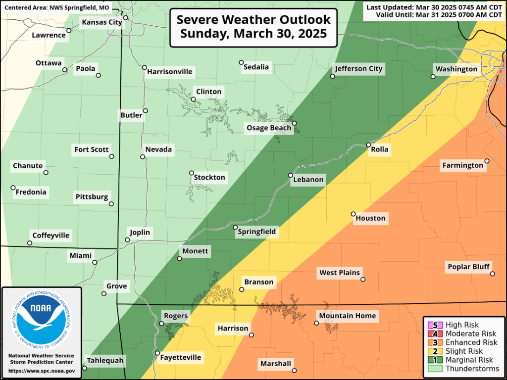
More thunderstorms are expected on Sunday afternoon. The Storm Prediction Center shows part of Taney, Ozark, Douglas and Howell Counties in a Level 3 “Enhanced Risk” for severe weather, with large to significant hail, damaging winds and tornadoes possible.
The greatest risk for tornadoes Sunday afternoon will be in southeast Missouri.
Areas along a line from Branson to Rolla are in a Level 2 “Slight Risk” for severe weather, with the Springfield are in a Level 1 “Marginal Risk.”
We’ll keep you up to date on any watches and warnings on 93-3 and A-M 560 KWTO.