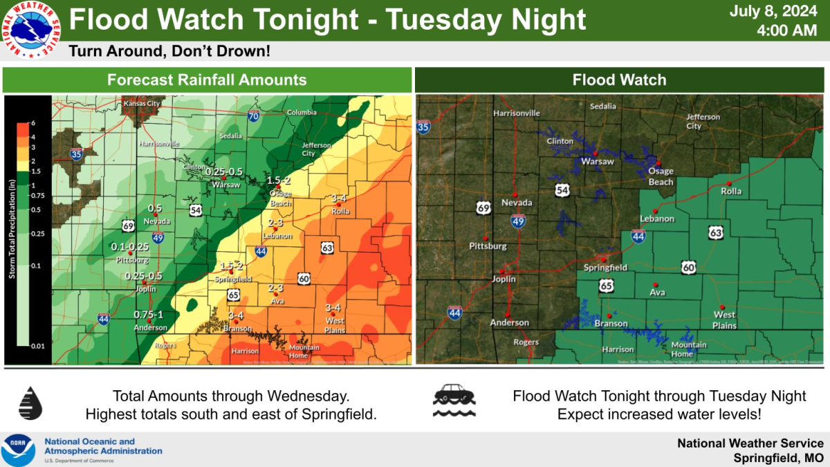
The remnants of Hurricane Beryl will increase rain chances in the Ozarks Monday night through Tuesday, with the highest chances south and east of Springfield.
The National Weather Service has issued a Flood Watch for areas south of I-44 for that same period, where localized rain amounts as high as four to six inches could occur. Amounts to the west will be much lower.
Forecasters say the severe weather threat overall remains low, but the remnants of Beryl could cause a few severe storms Monday night into early Tuesday morning to the southeast of Springfield.
Potential hazards include 50 to 60 mile per hour winds and a brief tornado.
We’ll keep you up to date with any watches and warnings on 93-3 and A-M 560 KWTO.