We have several chances for storms to develop and push through the Ozarks over the next several days.
The National Weather Service says there’s a marginal risk (level 1 out of 5) for isolated strong to severe thunderstorms Wednesday evening, with better chances north, west and southwest of Springfield.
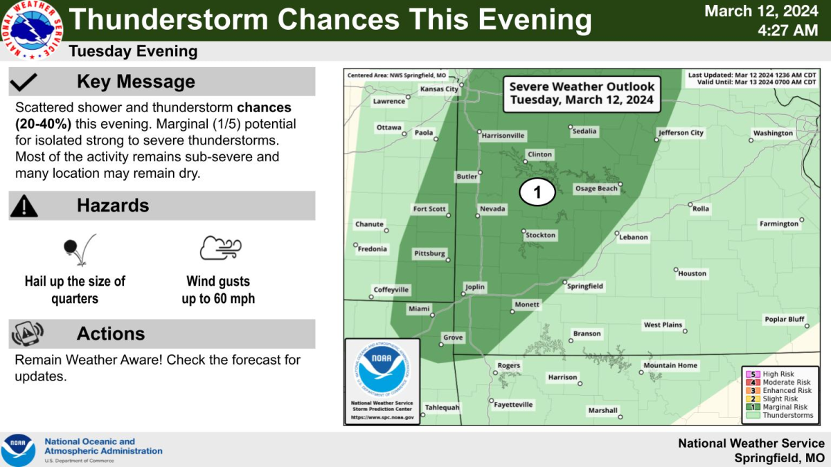
The next threat of storms comes Wednesday evening into early Thursday. Forecasters say there’s a marginal potential for isolated strong to severe thunderstorms containing quarter size hail and 60 mile per hour winds, but the better potential remains northwest of the area, and many locations may remain dry.
More scattered shower and thunderstorms chances are on the way Thursday into Thursday night, with a level 2 slight risk for severe weather across much of southwest Missouri along a cold front.
The main threats from round three will be hail up to the size of half dollars and damaging winds up to 60 miles per hour.
We’ll have any watches or warnings live on 93-3 and A-M 560 KWTO.