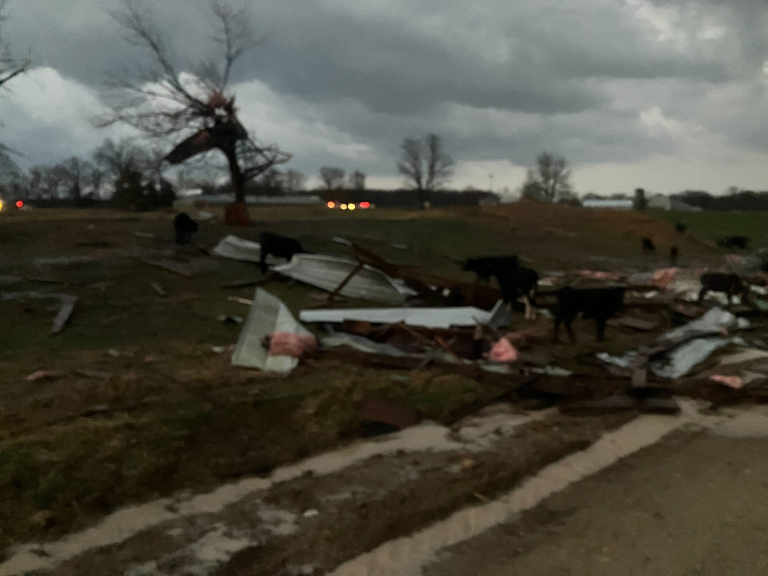
UPDATE: 10:00pm Friday: The National Weather Service reports a large tornado debris signature emerged from a tornado that tracked through the Bakersfield area. Radar showed debris reaching at least 18,000 feet into the air as the tornado passed in the Bakersfield area. This is indicative of a strong tornado. A volunteer firefighter in the area says storm damage assessments are underway. A tornado was also reported at the Moody Fire Department in Howell County. Golf ball size hail was reported in the Nebo area. We’re getting reports of multiple houses destroyed along County Road 9000 in Howell County.
UPDATE: 8:03pm Friday: The Severe Thunderstorm Watch for areas west of Highway 65 is no longer in effect. We’ve had several reports of rotation and wall clouds and a number of tornado warnings and severe thunderstorm warnings issued late Friday afternoon into the evening.
We had reports of golf ball size hail in the Ozark area.
Webster County Emergency Management reports no confirmed injuries, just some scrapes and bruises with multiple structures down along Highway P.
Original Story: Damaging winds of up to 60 miles per hour, followed by severe thunderstorms that could produce tornadoes in the Ozarks by early Friday evening: It’s a wild weather day in southwest Missouri.
We’ve had several Severe Thunderstorm Warnings issued late in the afternoon for Greene, Northwestern Christian, and other areas along and west of Highway 65.
The National Weather Service has issued a Tornado Watch for the Springfield metro area and all areas along and east of Highway 65 until 11:00pm.
The National Weather Service has issued a Severe Thunderstorm Watch until 7:00pm Friday for areas west of Highway 65, where damaging winds of more than 70 miles per hour, large hail and a couple of tornadoes are possible.
The threat will then shift to areas along and east of Highway 65 as we head into this evening, with the tornado threat increasing the farther east you go.
We’ve already had numerous reports grass fires and power lines down in parts of the Ozarks.
A High Wind Warning is in effect until 1am Saturday, with south winds at 30 to 40 miles per hour with gusts up to 65 miles per hour expected.
We’ve had reports of a brush fire causing heavy smoke eastbound on I-44 near the Glenstone exit in Springfield.
Other reports include a wire down along east Mill Street in Willard, and a wire down on east Harrison Street in Republic.
As of 4:30pm, City Utilities of Springfield is responding to more than 950 outages in the city.
Christian County residents were bombarded with golf ball to pea sized hail.
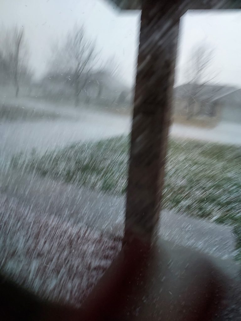
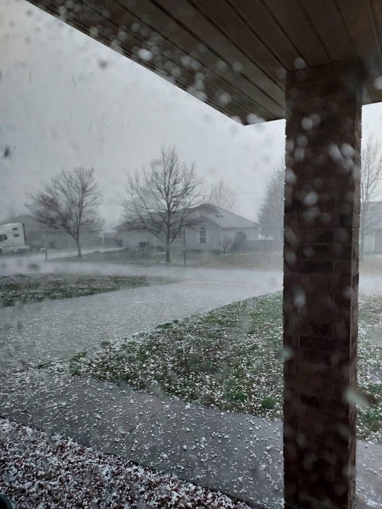
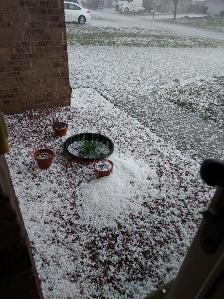
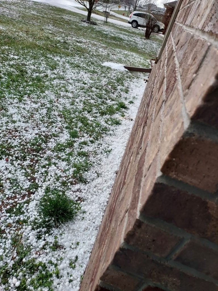
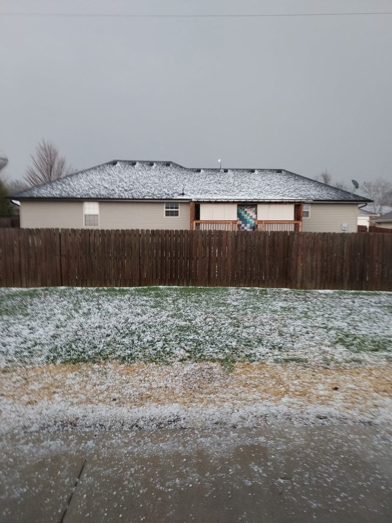
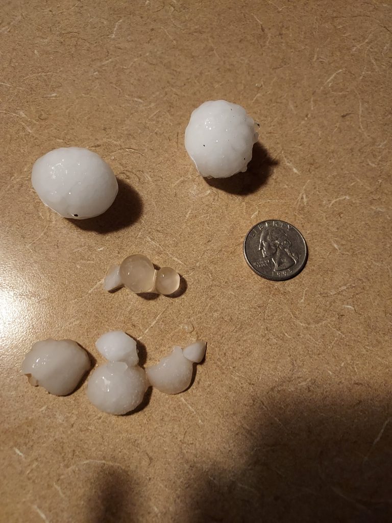
These photos were provided by Diala Brown of Sparta.