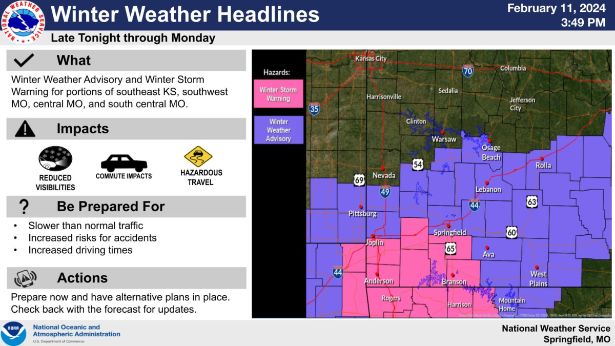
A band of heavy snow is expected to develop over the Ozarks late Sunday night into Monday, with the National Weather Service issuing a Winter Storm Warning for areas south and west of Springfield and a Winter Weather Advisory for the rest of the Ozarks.
Rain will turn to snow overnight.
Forecasters say the exact location of the heaviest band is still uncertain and may shift north or south depending on the exact track of the low.
The Winter Storm Warning is in effect from 2am-6pm Monday for Christian, Barry, Lawrence, Newton, McDonald, Stone and Taney Counties.
Heavy snow is expected in the warning area, with accumulations between 4 and 6 inches possible.
If the heavy snow band can stay over the same location for several hours, then localized higher amounts will be possible.
The rest of southwest Missouri is under a Winter Weather Advisory from 2am-6pm Monday.
Total snow accumulations of 2 to 5 inches are possible in the advisory area.
The snow will end Monday night.
The snow is expected to affect both the morning and afternoon commute Monday.
Get the latest briefing from the National Weather Service here.