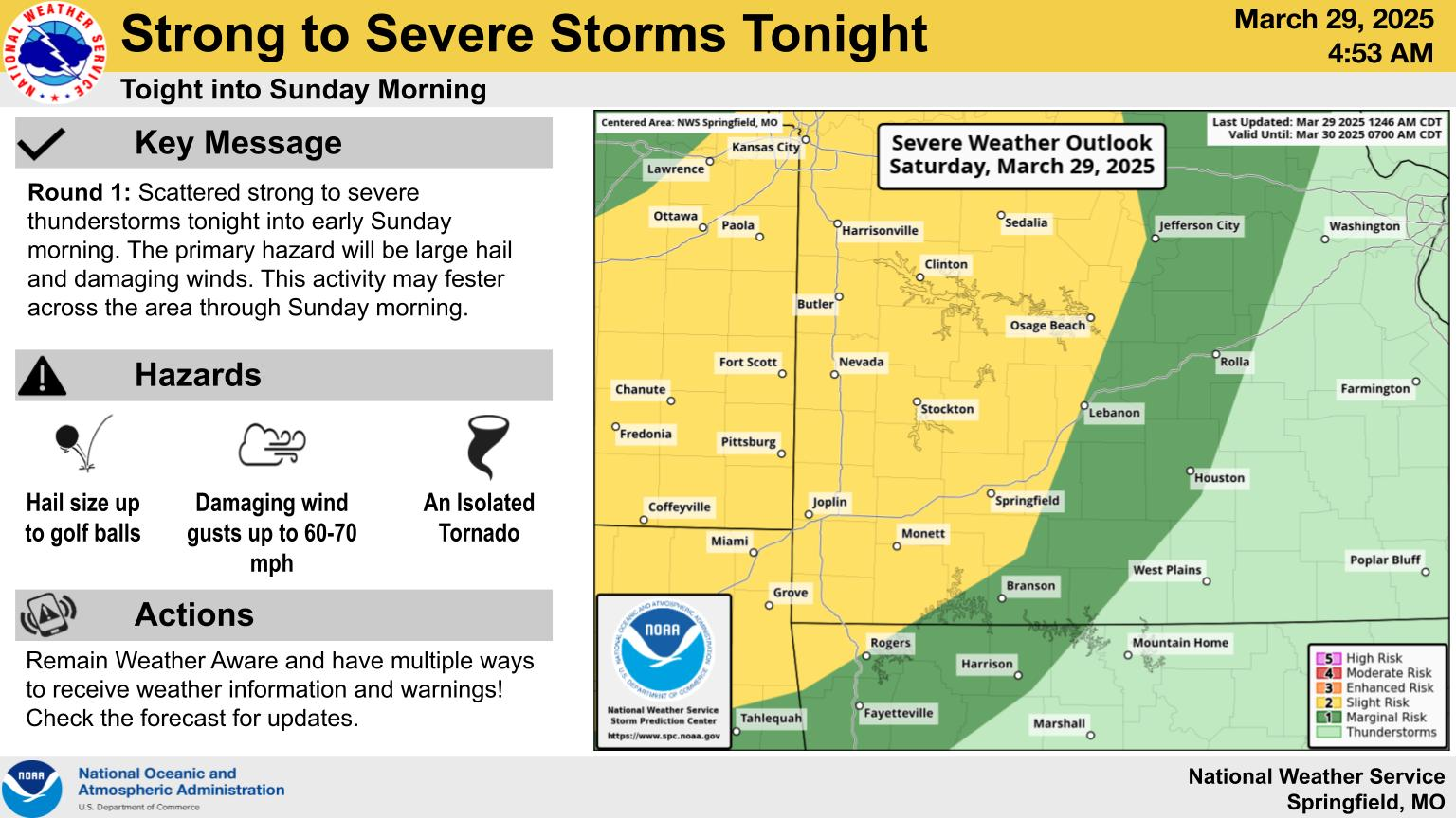
Scattered strong to severe thunderstorms will be possible late Saturday night into early Sunday morning, especially along and west of Highway 65.
The National Weather Service says the primary hazard with these storms will be large hail up to the size of golf balls and damaging winds up to 60 to 70 miles per hour, and this activity may linger across the area through Sunday morning.
Springfield and areas west of the metro area are under a Level 2 “Slight Risk” for severe weather, with areas along and east of a line from Branson to Lebanon under a Level 1 “marginal risk” for severe storms.
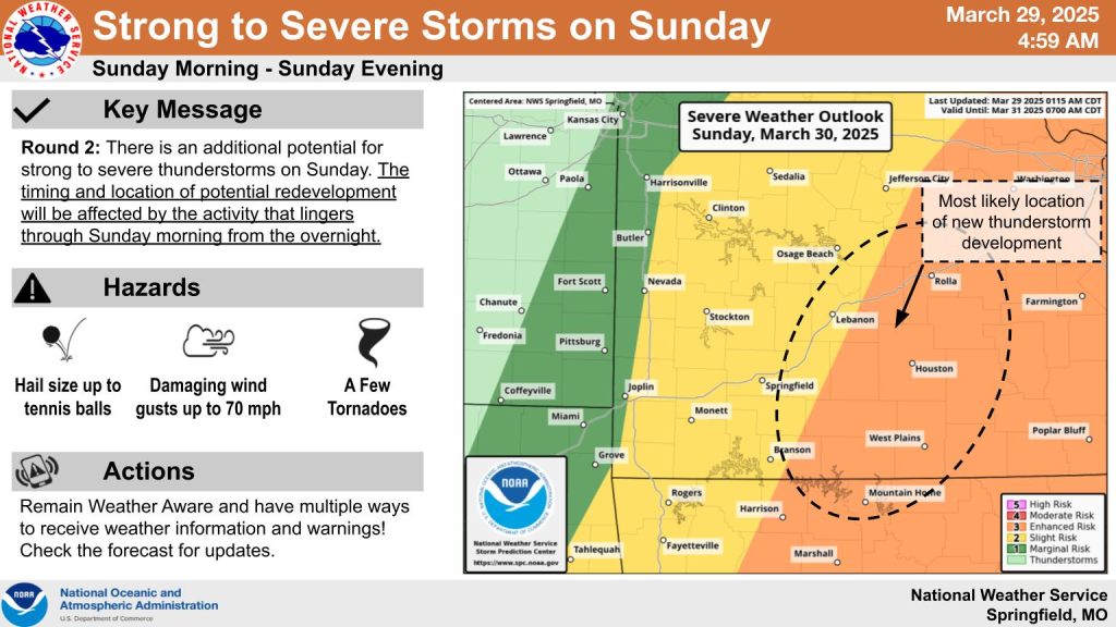
There is additional potential for severe weather on Sunday across southwest Missouri.

These storms, depending on where they develop, may produce all modes of severe weather, including up to tennis ball size hail, damaging winds up to 70 miles per hour, and a few tornadoes.
The National Weather Service says if the storms that move through in Round 1 early Sunday morning are more vigorous and last longer, that will cool down the atmosphere and advance the cold front through the area quicker, with initiation of storms Sunday afternoon occurring further east of our area.
If storms quickly dissipate across the area Sunday morning, that would allow much of the Ozarks to warm and destabilize, leading to more coverage and severity of Sunday afternoon storms, with initiation occurring further west.
Currently, forecasters say a third scenario appears plausible, which would lead to the first round of storms dissipating somewhere between Highway 65 and Highway 63, off to the east of Springfield, and that’s where Sunday afternoon storms would fire up.
We’ll keep you up to date with the weather and having any watches and warnings on 93-3 and A-M 560 KWTO.

