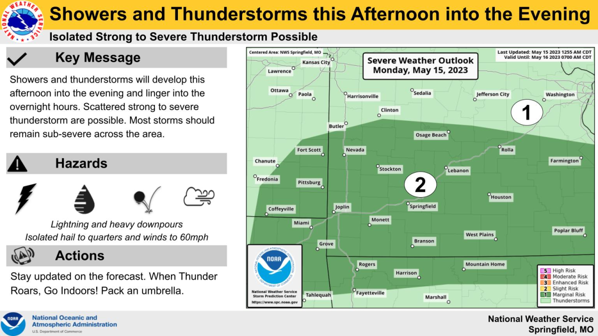
Showers and thunderstorms developing and moving across the Ozarks Monday afternoon and evening will bring both a severe and flash flood potential to the area.
The National Weather Service says scattered strong to severe storms are possible, although most storms should remain sub-severe across the area.
Forecasters say given the warm air aloft, thunderstorms with damaging winds to 60 mile per hour will be the most likely hazard, with hail confined to one inch or less.
The tornado threat is not zero, but the weather service says it’s very low overall.
There’s also a concern for flash flooding, with storms likely producing heavy rainfall rates of one to two inches per hour.
A corridor of one to three inches of rain is expected to occur near and along Interstate 44, with some localized amounts up to four inches.
A Flood Watch is in effect for all of southwest Missouri until 10 p.m. Monday.
The Storm Prediction Center says as of early Monday afternoon, the probability of issuing a Severe Thunderstorm Watch is only about 20%.