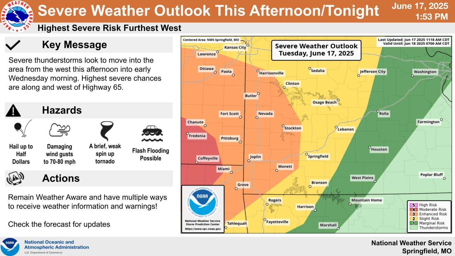
A couple of rounds of severe weather are possible in southwest Missouri, beginning late Tuesday night.
The National Weather Service says the highest risk for bad storms is further west of Springfield, with a Level 3 “enhanced risk” for severe weather from just north of Joplin up toward Nevada and Harrisonville.
Damaging winds up to 70 miles per hour and quarter size hail are possible, with a conditional threat for weak, spin-up tornadoes.
More widespread storms are expected Wednesday afternoon, with the area of highest risk in the eastern Ozarks.