
Storms that produced tornadoes and damaging wind gusts up to 90 miles per hour moved through the Ozarks Tuesday morning, downing trees and power lines and damaging homes and buildings.
In Springfield, we’ve had numerous reports of power lines down, trees down onto homes, with reports throughout the area of trees down blocking roadways.
As of 1:00pm Tuesday, Springfield City Utilities reports nearly 50,000 customers without power, and crews plan to work through the night to restore a number of downed lines.
Christian, Barry, Dallas, Dade and Lawrence Counties are also reporting outages.
The National Weather Service reported confirmed tornadoes near Fair Grove and Niangua, with a suspected tornado earlier doing damage in the Neosho area, with part of a barn blocking Interstate 49 at the 23 mile marker.
A MODOT building was damaged in Monett, and buildings in the Nixa area were also damaged.
The National Weather Service measured a 90 mile per hour wind gust at its offices near the Springfield-Branson National Airport as the tornado warning sirens were going off in Springfield.
Storms damaged a maintenance facility at the Springfield-Branson National Airport. High winds damaged the roof of the building where crews work on private aircraft.
There was no damage to the main terminal at the airport, and airlines resumed a regular schedule after the storms moved through the area.
A weather spotter reported a tree that collapsed part of a home near the golf course at Scenic and Sunshine in Springfield.
A Severe Thunderstorm Watch that was in effect for the eastern Ozarks has been cancelled.
93-3 and AM 560 KWTO is your home for severe weather coverage in the Ozarks, and we’ll keep you up to date with any additional bad weather that develops.
(Featured photo above—storm damage at Cedarbrook and Catalpa in Springfield, courtesy of Patricia Flowers-Palmer, SW MO Regional Skywarn).
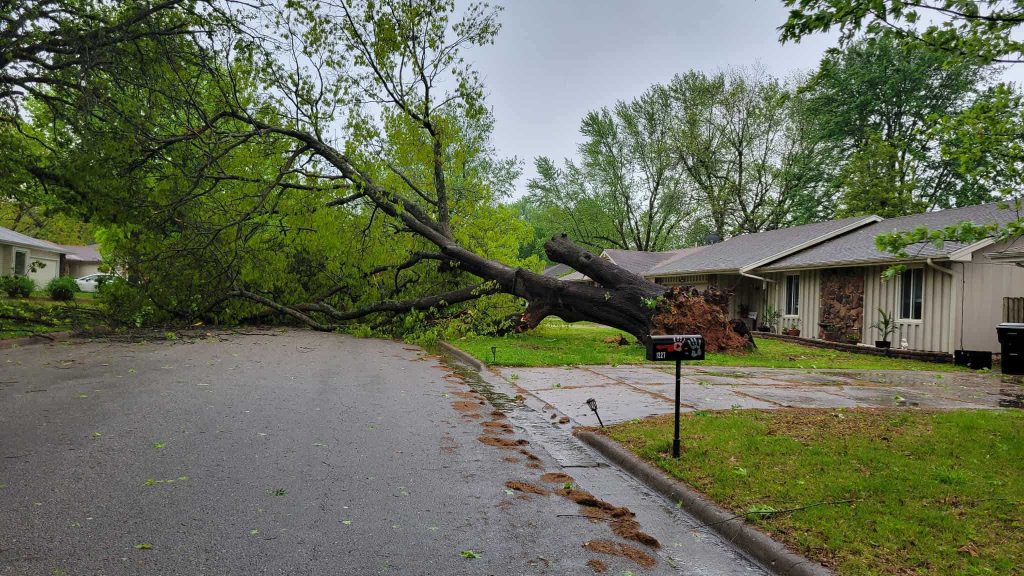
(Photo of tree uprooted on south John Avenue in Springfield, courtesy of Patricia Flowers-Palmer, SW MO Regional Skywarn)