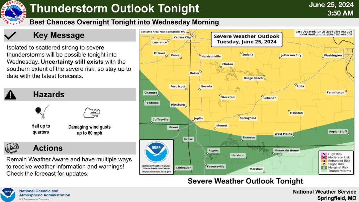
The National Weather Service in Springfield is warning residents of the possibility of scattered thunderstorms beginning tonight.
A cold-pressure system is working its way into the Ozarks this afternoon and evening, meeting the extreme heat the area has faced this past week.
Because of this, weather experts say areas including Joplin, Monett, Springfield and others south, and areas as far north as Nevada and Rolla could be effected by these storms.
Areas south, including Branson and West Plains, are a a marginal risk for scattered storms.
NWS says the hazards included in these storms could be up to quarter-sized hail, and wind gusts up to 60 miles per hour.