Widespread showers and thunderstorms are possible in the Ozarks Thursday evening through Friday, with severe storms possible.
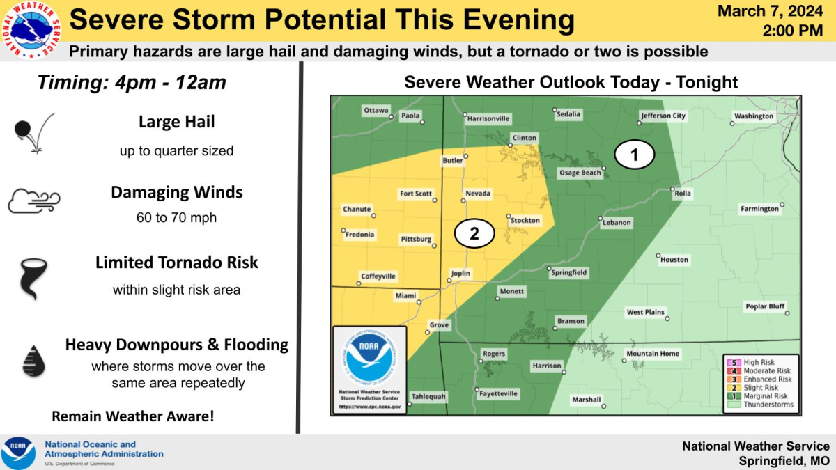
The National Weather Service says the timing of storms Thursday is between 4pm-12am, with primary hazards including large hail up to the size of quarters and damaging winds.
There will be a limited risk of a tornado or two in western Missouri, where areas along and west of a line from Grove, Oklahoma to near Buffalo are under a level two “slight risk” for severe weather.
All but the far eastern Ozarks is under a level one “marginal risk” for Thursday night.
Forecasters say the atmosphere will be conducive for thunderstorms and potential severe weather on Friday, but the exact details on timing, locations and hazard types are unclear.
Some areas have already received 1 to 1.5 inches of rainfall through noon Thursday, and generally, 0.5 to 1.5 inches of additional rainfall can be expected through Friday.
Localized areas with as much as 3-5 additional inches of rain are possible within the heaviest rain bands.
There will also be periodic breaks in the rain.
We’ll have any severe weather watches or warnings on 93-3 and A-M 560 KWTO.