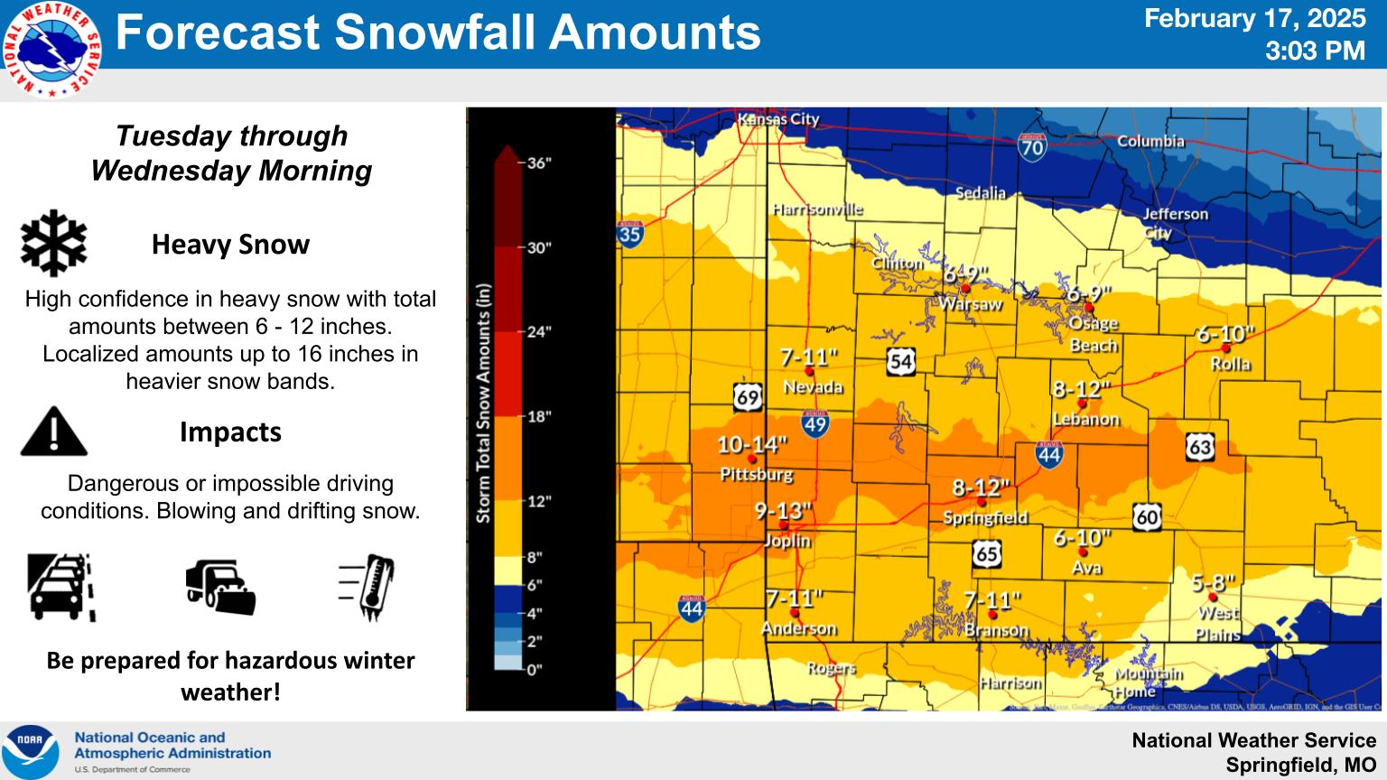
A winter storm will take aim on the Ozarks Tuesday with very heavy snow and travel impacts.
The National Weather Service has issued a Winter Storm Warning from 12am Tuesday through 6am Wednesday.
Forecasters say the snow begins early Tuesday morning and will be heavy at times throughout the day, with total accumulations between 6 and 10 inches possible.
Springfield-area snow totals could range closer to 7 to 12 inches.
Localized amounts up to 14 inches are possible in the higher bands of snow.
The heaviest snow is expected Tuesday morning through Tuesday night before ending Wednesday morning.
Travel could be very difficult to impossible. The hazardous driving conditions could impact the Tuesday morning and evening commutes.
The weather service says infrastructure/business closings are likely, and many schools could shut down for multiple days.
Snow probability charts show a 65% chance of 8 or more inches of snow in the Springfield area, with a 22% chance of greater than 12 inches of snow.
Since 2000, only one snowstorm has resulted in greater than 8 inches of accumulation in Springfield, and that came on December 13th, 2000, when we received 13.7 inches of snow.
We received 7.8 inches two days before Christmas in 2002, the infamous “traffic gridlock” day.
We’ll keep you up to date with the latest forecast changes plus road conditions and other snow impacts on 93-3 and A-M 560 KWTO.
