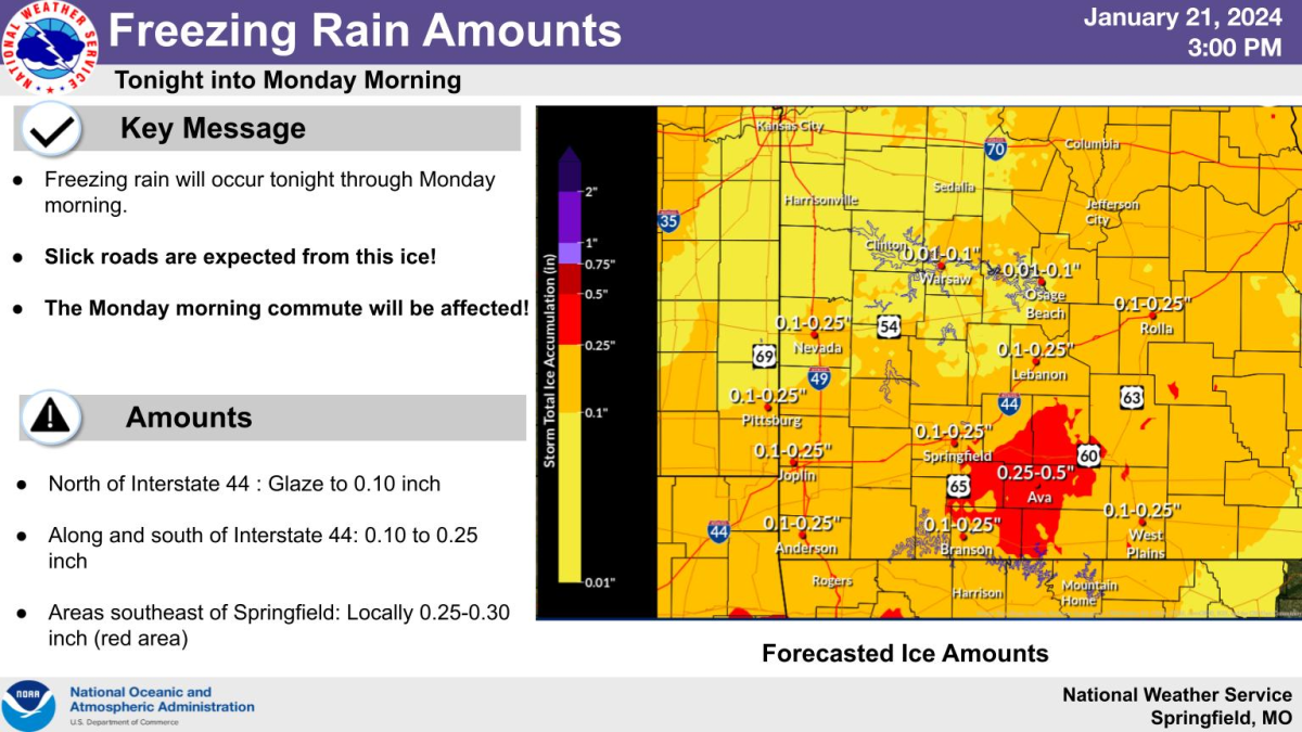
Freezing rain will move into the Ozarks late Sunday night and last through Monday morning.
The National Weather Service says ice will accumulate and this will affect the Monday morning commute.
North of Interstate 44, a glaze to .10 inch of ice is expected, with areas along and south of I-44, including the Springfield metro area, expected to have ice accumulations of .10 to .20 inch.
Localized ice amounts from .25 to .30 inch are possible southeast of Springfield, which could cause a few power outages, with wind gusts of 25 to 30 miles per hour adding to the problem.
Forecasters say probabilities are greater than 75% that we will see travel impacts, especially on untreated roads and overpasses.
The weather service says the wintry weather may start with brief sleet, arriving in the Joplin area as early as 9 p.m. Sunday and in the Springfield and Branson areas by midnight.
The sleet will change over to freezing rain during the overnight hours and continue for most of the morning for the Springfield metro area.
The freezing rain will then change over to all rain Monday as temps rise. This could start as early as 9 a.m. in the Joplin area and around noon in Springfield and Branson, with areas southeast of Springfield like Ava, West Plains and Houston, potentially not seeing a changeover to rain until around 3 p.m.
Click here for the latest winter weather packet from the National Weather Service, with additional information on the Winter Weather Advisory, forecast ice amounts, and probabilities on accumulations.
Keep tuned to 93-3 and A-M 560 KWTO during the morning commute Monday for the latest on the freezing rain, road conditions, school closings and other important winter weather information.
