Excessive Heat in the Ozarks This Week
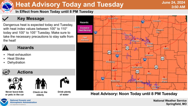
Monday will mark the hottest day of the year so far in southwest Missouri, with a Heat Advisory in effect from noon on Monday through 8 pm on Tuesday. The National Weather Service says heat
Monday will mark the hottest day of the year so far in southwest Missouri, with a Heat Advisory in effect from noon on Monday through 8 pm on Tuesday. The National Weather Service says heat
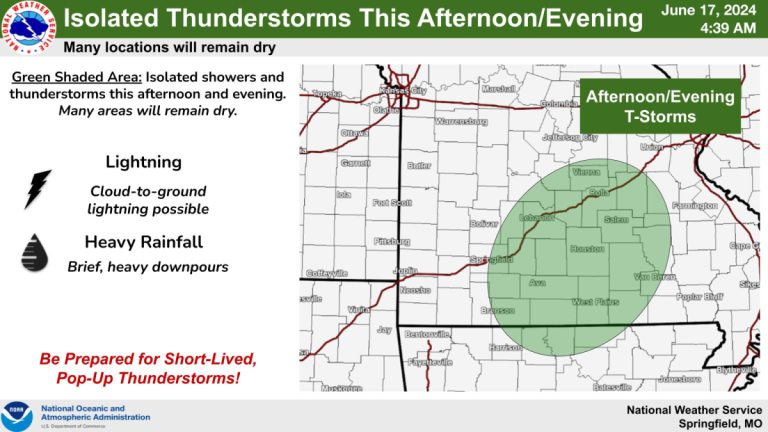
The heat and humidity will continue in the Ozarks Monday, with isolated showers and thunderstorms possible in the afternoon and evening. The National Weather Service says most areas will remain dry, and the best chance

Damaging winds, hail up to the size of golf balls and torrential rainfall producing flash flooding have accompanied storms that moved through the Ozarks Saturday evening into Sunday morning. Several parts of the Ozarks, including
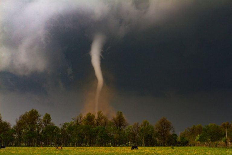
Severe thunderstorms and a tornado rolled across the Ozarks Sunday afternoon. A series of thunderstorms with hail passed through Laclede, Dallas, Webster, Greene, Christian, Douglas, and Taney Counties. There were reports of penny sized hail

UPDATE: Hail up to the size of large hen eggs, damaging winds of 70 plus miles per hour and several reports of tornadoes on the ground highlighted a long night of severe weather in the
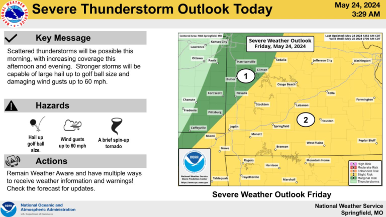
More showers and thunderstorms are possible as we head into the Memorial Day weekend, but there will be several dry periods, too. The National Weather Service says scattered thunderstorms will be possible Friday morning, with
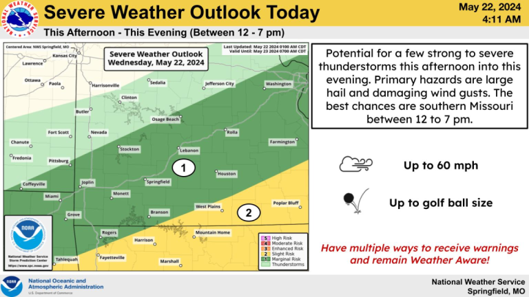
The National Weather Service in Springifeld says a few strong to severe thunderstorms will be possible Wednesday morning into the evening. The storms will be capable of producing damaging wind gusts and golf ball size
Severe weather is a good bet in the Ozarks from late Tuesday afternoon into Tuesday night. The National Weather Service says the primary concern will be large hail up to two inches in diameter and
The National Weather Service has rated the tornado that touched down at a golf course near Hollister Monday. The Weather Service says that an EF-1 tornado touched down at Payne’s Valley Golf Course at 4
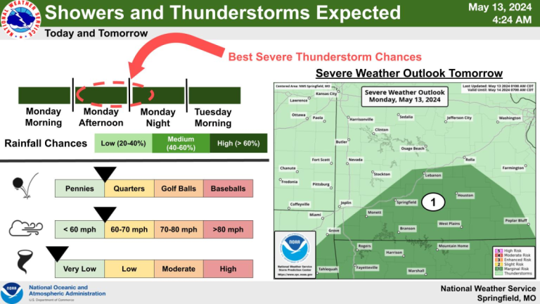
Showers and thunderstorms will move back into the Ozarks Monday and last into Tuesday. The National Weather Service says widespread rainfall totals of 1 to 1.5 inches are expected, with localized amounts up to 2-3
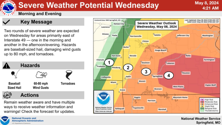
UPDATE: 12:30 P.M.: A Tornado Watch is in effect for all of southwest Missouri until 7:00 p.m. Wednesday. Large hail to the size of baseballs, damaging winds of 60 to 80 miles per hour, and
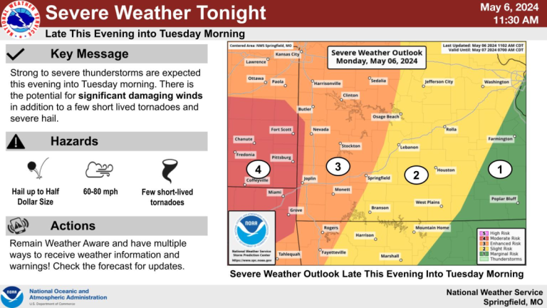
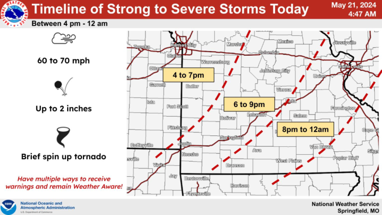
Thunderstorms are expected to move across the Ozarks late Monday night into Tuesday morning, with the potential for significant damaging winds, in addition to a few short-lived tornadoes and severe hail. The National Weather Service